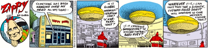
… in Palo Alto, in yesterday’s Zippy:
 (#1)
(#1)
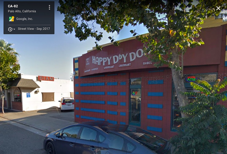
Happy Donuts at 3916 El Camino Real, in the Barron Park neighborhood of Palo Alto, just south of the Stanford Industrial Park, itself just south of the College Terrace neighborhood (on the west) and the California Avenue shopping district (on the east), these being just south of the university (on the west) and downtown Palo Alto and the Professorville and Old Palo Alto neighborhoods (on the east). My neighborhoods.
Happy Donuts, outside (in sprightly colors) and in (where looms the gigantic custardy torus):
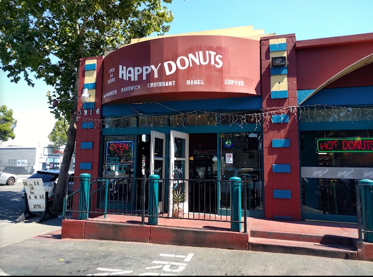
(#2) Note: open 24 hours
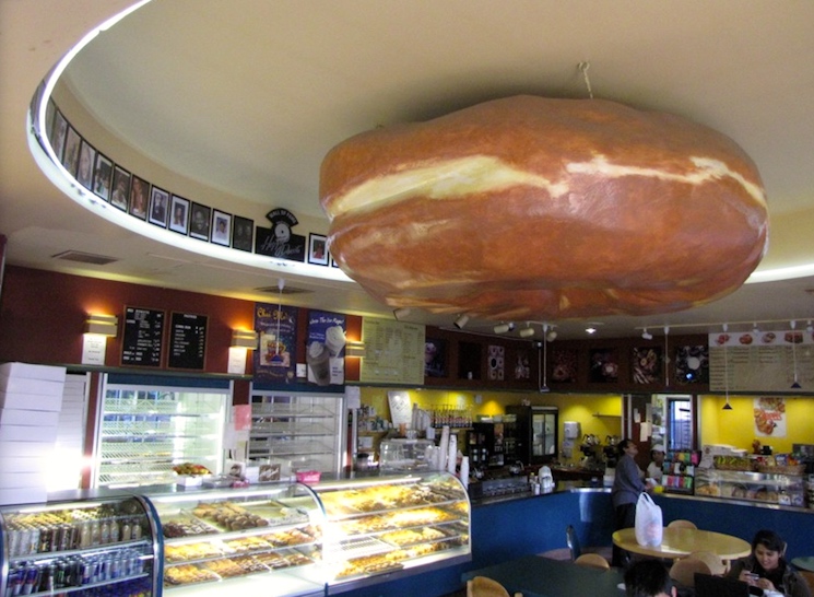 (#3)
(#3)
Yesterday was not Zippy’s first visit to Happy Donuts. Back on 7/10/05:
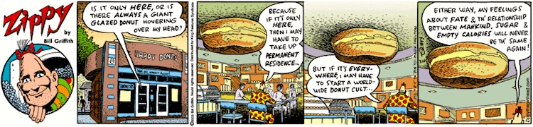 (#4)
(#4)
This artwork is repurposed in #1, with new coloring and fresh text.
The neighborhood, in a Google map:
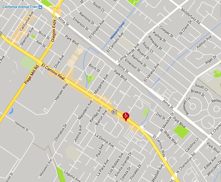 (#5)
(#5)
The map is conventionally oriented, with up representing north. But in local usage, directions are named according to the locations they point to: north means ‘towards San Francisco’, south ‘towards San Jose’. In this usage, the major streets Middlefield Ave., Alma St., and El Camino Real run north and south, and California Ave., Page Mill Rd. / Oregon Expressway, and Charleston Rd. run east and west. Happy Donuts is thus on the west side of El Camino, between Barron and Los Robles.
Some photos of its immediate neighborhood:
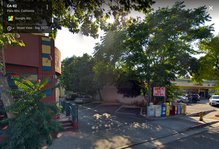
(#6) To the north: a small strip mall, with the Barron Park Market, a grocery, at 3876 El Camino, in it
(#7) To the south: Siam Fine Thai Cuisine, 3924 El Camino
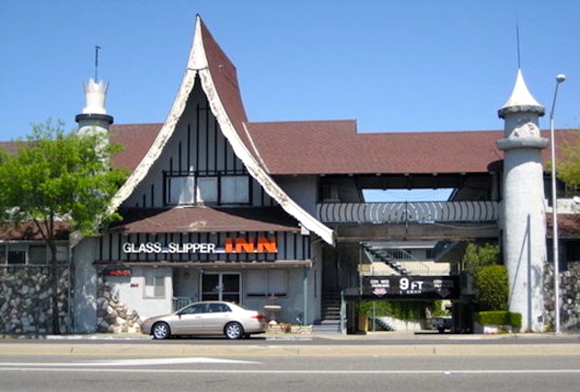
(#8) More or less across the street: the Glass Slipper Inn, 3941 El Camino
The Glass Slipper Inn (a budget motel) has been a prominent feature of the neighborhood for decades.
The neighborhoods in the map are full of places where my colleagues and friends have lived. Until his death, the linguist Dwight Bolinger (see Act 3 in this posting) lived on Ramona St. in Old Palo Alto (I live on Ramona St. in Downtown South; Kim Darnell and her daughter Maggie live in what was once my “library condo” in College Terrace). And the linguists Tom Wasow and John Rickford have long lived in Barron Park. And so on.
Leave a Reply