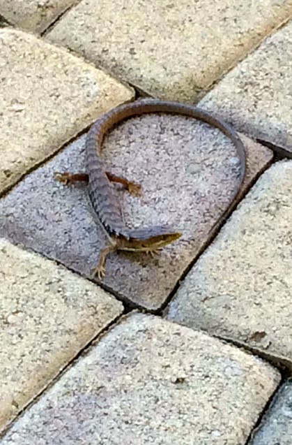
From Ela Thurgood on Facebook today, this photograph of a recent visitor to Ela and Graham’s house in Chico CA:
(#1) An alligator lizard, presumably a southern alligator lizard, Elgaria multicarinata; alligator lizards are a western US thing
That’s in Chico, in NorCal. But at least since 1972, alligator lizards have been famous as a SoCal phenomenon, celebrated in song as apparitions in the air above “Ventura Highway”:
(#2) DeviantArt by nightly03 illustrating America’s “Ventura Highway”

The reptile. From Wikipedia:
The southern alligator lizard (Elgaria multicarinata) is a common species of lizard native to the Pacific coast of North America. It ranges from Baja California to the state of Washington and lives in a variety of habitats including grasslands, chaparral, forests, and even urban areas. In dry climates, it is likely to be found in moist areas or near streams.
The generic name Elgaria is possibly named for an “Elgar” or a pun on “alligator.” The specific name multicarinata refers to the keeled scales characteristic of this species. The common name “alligator lizard” is a reference to the fact that the back and belly scales of these lizards are reinforced by bone, as they are in alligators.
… The southern alligator lizard frequently can be found near human habitation, and is often seen foraging in the mornings and evenings. It is often found in or around suburban yards and garages. E. multicarinata is notable for its vicious self-defense, and will bite and defecate if handled.
On the other hand, alligator lizards (of several species) are sometimes kept as pets.
The music. From Wikipedia:
(#3)
“Ventura Highway” is a 1972 song by the band America from their album Homecoming.
Dewey Bunnell, the song’s vocalist and writer, has said that the lyric “alligator lizards in the air” in the song is a reference to the shapes of clouds in the sky he saw in 1963 while his family was driving down the coast from Vandenberg Air Force Base near Lompoc, California, where they had a flat tire. While his father changed the tire, his brother and he stood by the side of the road and watched the clouds and saw a road sign for “Ventura”.
… [Bunnell:] “I remember vividly having this mental picture of the stretch of the coastline traveling with my family when I was younger. Ventura Highway itself, there is no such beast, what I was really trying to depict was the Pacific Coast Highway, Highway 1, which goes up to the town of Ventura.”

You can listen to the song here (#4). The relevant lyrics:
Ventura Highway in the sunshine
Where the days are longer
The nights are stronger
Than moonshine
You’re gonna go I know‘Cause the free wind is blowin’ through
Your hair
And the days surround your daylight
There
Seasons crying no despair
Alligator lizards in the air
The roads. Bunnell identifies VH as the Pacific Coast Highway (the name for some sections of the coast-hugging SR 1 that runs from San Diego to Mendocino), but at Ventura the name Ventura Highway would naturally be taken as the name for the Ventura Freeway, the section of US 101 that runs through the area. From Wikipedia:
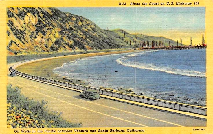
(#5) A 1940s postcard showing a section of the Ventura Freeway, a section that is now both US 101 and SR 1U.S. Route 101, or U.S. Highway 101 (US 101) is a north–south United States Numbered Highway that runs through the states of California [with its southern terminus in Los Angeles], Oregon, and Washington, on the West Coast of the United States. It is also known as El Camino Real (The Royal Road) where its route along the southern and central California coast approximates the old trail which linked the Spanish missions, pueblos, and presidios. It merges at some points [in particular, around Ventura] with California State Route 1 (SR 1).
Though US 101 remains a major coastal north–south link along the Pacific coast north of San Francisco, it has been replaced in overall importance for transport through the West Coast states by Interstate 5 (I-5), which is more modern in its physical design, goes through more major cities, and has more direct routing due to significantly easier geography over much of the route. US 101 is a major parallel route between Los Angeles and San Francisco, and is an alternative to the Interstate for most of its length.
(On the sections of SR 1 that are known as the Pacific Coast Highway in the L.A. area (south of Ventura), see my 3/26/17 posting “On the boulevard of broken dreams with Kip Noll”.)
The Wikipedia 101 article introduces two further north-south routes, the much more recent I-5 (running through the middle of the Central Valley) and the much older El Camino Real, the road connecting the Spanish missions of Alta California, from San Diego to Sonoma, usually running close to the modern route of US 101 (in Palo Alto, El Camino — locally, SR 82 — is about two blocks west of my house, while 101 runs close to the San Francisco Bay, a couple of miles to the east of me).
The Franciscan missions along El Camino Real were established to convert the local Native American groups to Roman Catholicism and impose European cultural practices on them — both seen as “civilizing the savages” — while exploiting them as sources as agricultural labor. Meanwhile, El Camino Real was the highway of the Spanish Conquest in Alta California, the road for the military and commercial enterprises of the empire. The road ran mostly through the coastal valleys; Palo Alto lies in the Santa Clara Valley between the missions of Santa Clara and San José, to the south, and Mission Dolores in San Francisco, to the north.
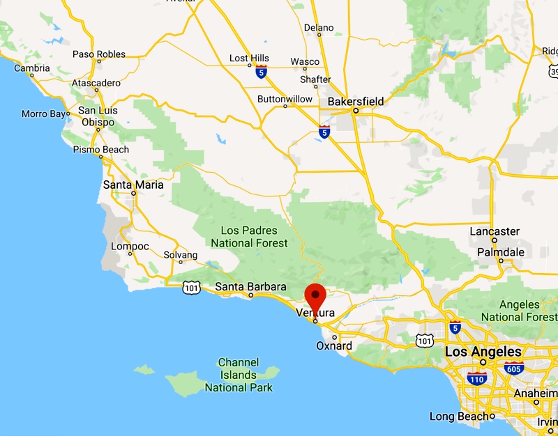
The Ventura map:
(#6) Map showing section of US 101 through Ventura and Santa Babara, where it coincides with SR 1 (and largely follows the route of the Spanish El Camino Real; missions were established in Ventura — San Buenaventura — and Santa Barbara)
The 101 freeway at Ventura and Santa Barbara is periodically in the national news: the forested mountainsides along it burst into apocalyptic flames, incinerating everything in their path, from the real estate down to the animals of the forest, even the little alligator lizards. If there are any floating in the air, they too go up in smoke.
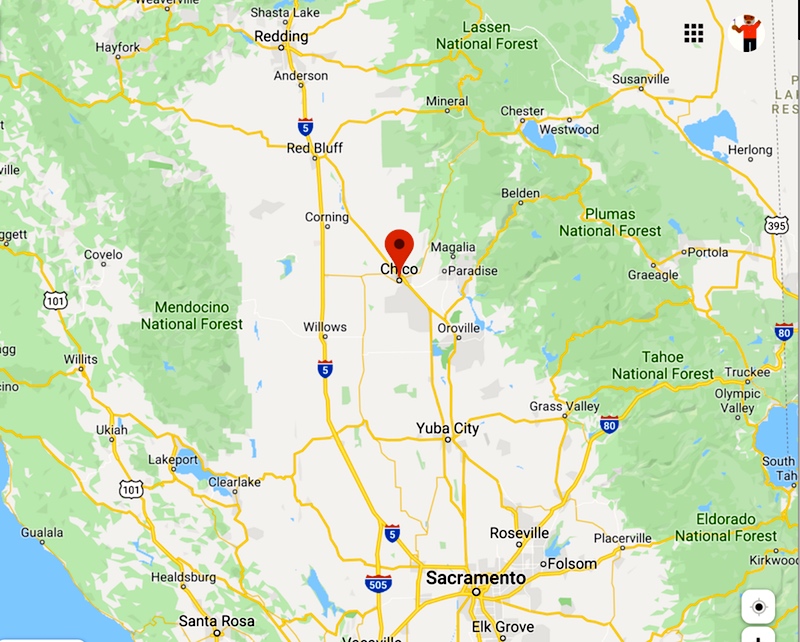
Meanwhile, up north in Chico:
(#7) On the coast, SR 1 through Gualala; to the east, US 101 through Santa Rosa and Healdsburg to Willits and Leggett; further east, I-5 from Sacramento north to Redding; and just a bit further east, SR 99, with Chico lying between Yuba City and Red Bluff (still further to the east: Nevada)
This, too, is now-famous wildfire territory. Chico, in particular, is the place people fled to when the town of Paradise (to the east) was leveled in the 2018 Camp Fire, the deadliest and most destructive wildfire in California history.
Otherwise, it’s a pretty place and the site of Cal State Chico, which is why Ela and Graham are there. Plus, it has alligator lizards, though I hear that they’re all firmly terrestrial — unlike the ones in Ventura, with their known aerial inclinations.
November 12, 2019 at 3:31 pm |
[…] Zwicky looks at lizards and at California’s legendary Highway […]